Guide to Cedar Creek
Paddle Cedar Creek
Tadd Bowman
Paddling Cedar Creek (Tadd Bowman)
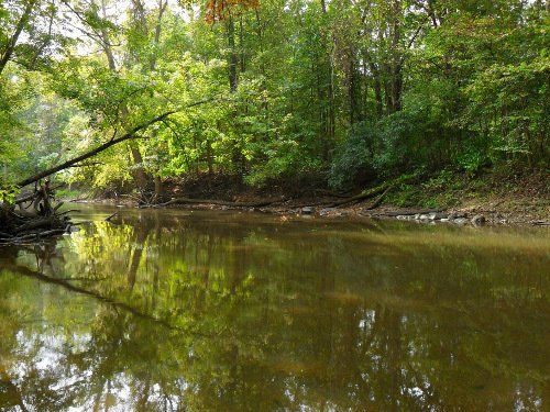
Cedar Creek has a lot to offer paddlers. This deeply carved narrow stream has timbered ridges and steep slopes with some fantastic paddling and wildlife viewing.
Starting at
Cook’s Landing (see below), this section of the stream can have many challenging logjams and strainers (trees or limbs that block the path)--very difficult to maneuver at low water levels. While these natural barriers can make paddling challenging, they benefit the creek and its inhabitants by oxygenating the water and keeping backwaters from becoming stagnant--helping keep the water clear and clean!
As you move in and out of your kayak to go over these always-changing natural river barriers, be sure not to leave any human evidence (such as bottles, cans) in the creek or along its banks. Keep the creek natural--so its wildlife can live, and kayaking humans can enjoy its beauty.
As the stream skirts some partial canyons near the Rodenbeck and
Vandolah Nature Preserves, there are very few housing areas. The scenic seasonal views are breathtaking as you paddle through the passage underneath Cedar Canyon Road and I-69. It’s a 4-mile paddle to the next take-out on Tonkel Road, NW bridge, which has corner roadside parking and a steep bank leading down to the river.
The
Hursh Bridge access take-out of Metea County Park is about a 300-yard carry to the parking lot. The Brittany Overlook is evidence that you’re within the
Metea Park area. The next take-out is Cedarville, DNR public access SE corner, SR 1, west of Cedarville.
This is a beautiful natural stream to paddle, especially with the right water level. It is common to see wildlife, including an occasional nesting eagle.
Access locations:
- Cedarville DNR public access - SE bridge corner, SR1, located 8 miles West of Cedarville and one mile from the St. Joseph River.
- Cook’s Landing - a 4-acre Allen County Park, NE of Huntertown at junction of Coldwater Road and Shoaff Road.
- Metea Park, Hursh Bridge - access 300 yard carry from parking lot.
- Tonkel Road - NW Bridge corner roadside parking, 4 miles.
More to Explore . . .
- Flatwater Paddling Guide: Cedar Creek. http://water.schutt.org/indiana/cedar-creek.html.
- Indiana Outfitters. http://www.indianaoutfitters.com.
- Paddle Indiana, A. McPherson, J.L. Waters & Co., 2000.


