Friends of Cedar Creek works to ensure the highest water quality for Cedar Creek and to protect and preserve its watershed including geologic features, native plants and animals.
Next Meeting:
Wednesday, May 15, 6pm
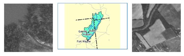
Guide to Cedar Creek
The History of Cedar CreekAn Outstanding Hoosier Resource
Called Mes-kwah-wa-se-pe by Native Americans (the name means"old red wood creek"), Cedar Creek in Allen and DeKalb Counties is one of only three streams included in Indiana's Natural, Scenic and Recreational Rivers System [310 IAC 4-2-1]. The others are the Blue River in Harrison, Crawford and Washington Counties and Wildcat Creek in Tippecanoe and Carroll Counties.
At the end of the last ice age, the upper part of Cedar Creek began as an "ice-marginal" channel at the western edge of the Erie Lobe of the glacial ice and formed a single stream with the Eel River in what is now Whitley County. This "ancestral Eel River" was also fed by glacial meltwater surging through a sub-ice channel or "tunnel valley" which can be seen today as the beautiful Cedar Creek Canyon area of northern Allen County.
Ancestral Lake Erie shrank quickly as its waters drained southwest to the Wabash. The ancient lakebed became the Great Black Swamp.
More Cedar Creek History


- Left: Indiana Department of Natural Resources map showing Saginaw and Erie glacial lobes about 20,000 years ago.
- Center: Michigan State Univerisity relief map showing retreating Saginaw and Erie lobes 14,000-15,000 years. The Cedar Creek-Eel River system formed in the region between the two lobes.
- Right: Illinois State Museum map showing ancestral Lake Erie extending into Indiana about 14,000 years ago.
As glacial melting continued and the Erie Lobe retreated eastward, Cedar Creek shifted its course into the tunnel valley to become a tributary of the St. Joseph River to the southeast, the valley portion actually reversing its flow. In so doing, Cedar Creek cut off the Eel from its original headwaters, becoming what geologists call a "pirate stream." The Eel River-Cedar Creek aquifer system consists of sediments and outwash laid down when the two streams were connected. The result of Cedar Creek's "piracy" was to increase the size of the Maumee River drainage system at the expense of that of the Wabash.
Origins of Cedar Creek
These diagrams from The Environmental Geology of Allen County, Indiana (Special Report No. 13), published by the Indiana Department of Natural Resources, show the probable stages of Cedar Creek's development at the end of the last ice age.

Summary: Sequential Development of Cedar Creek
- Cedar Creek Canyon forms as a sub-ice channel of the Wisconsin Glacier's Saginaw Lobe;
- The Saginaw Lobe retreats and the canyon is buried by the advancing Erie Lobe;
- The ancestral Eel River, which includes upper Cedar Creek, forms as an ice-marginal channel to the Erie Lobe;
- Cedar Creek Canyon, now a sub-ice channel of the Erie Lobe takes drainage from the melting Erie Lobe into the ancestral Eel River;
- The St. Joseph River forms at the edge of the Fort Wayne Moraine and takes drainage from Lake Maumee to the Wabash River; Cedar Creek Canyon takes drainage from the St. Joseph to the Eel;
- Outwash from Cedar Creek Canyon "beheads" the Eel, diverting upper Cedar Creek into the canyon, making it a tributary of the St. Joseph;
- The Maumee River opens as Lake Maumee recedes; the St. Joseph reverses flow, making the Cedar Creek watershed part of the Maumee drainage system.
Source: Bleuer and Moore, Environmental Geology of Allen County, Indiana (Special Report No. 13), published 1978 by the Indiana Department of Natural Resources. (Out of print. Special thanks to DeKalb County amateur geologist Ed McDonald for making his copy available.)
Other Reference: Jack A. Sunderman, "The Three Faces of Cedar Creek," ACRES Quarterly, vol. 39, no. 4 (Autumn 2000), pp. 6-7, published by ACRES Land Trust, Inc., 2000 N. Wells St., Fort Wayne, IN 46808-2474.
Cedar Creek itself fell victim to stream piracy by Fish Creek to the northeast, which captured the Cedar's headwaters in what is now Steuben County to connect directly with the St. Joseph. DeKalb County's Matson Ditch, a tributary of the Cedar, follows the Cedar's old floodway through Franklin, Smithfield and Grant Townships.
Today's Cedar Creek rises at Indian Lake in northwest DeKalb County (although its identity as a legal drain begins downstream near Cedar Lake) and drains nearly 175,000 acres before meeting the St. Joseph River near Cedarville in Allen County. Once a meandering stream, the DeKalb County portion of Cedar Creek was "channelized" in about 1900. A few segments of the original channel -- generally oxbows cut off by the ditching -- survive as seasonal wetlands in the creek's flood fringe. One such segment lies in the Terri Hague Nature Area between Eckhart Park and Woodlawn Cemetery in Auburn. Another segment on the grounds of Greenhurst Country Club in Auburn was filled in 1998.

The southern part of Cedar Creek -- from river mile 13.7 (at County Road 68 in DeKalb County) to its confluence with the St. Joseph -- is designated by the Indiana Department of Environmental Management as "an outstanding state resource" [327 IAC 2-1-2], a distinction it shares only with the Blue River and Wildcat Creek (mentioned above), the Indiana portion of Lake Michigan and the waters inside the Indiana Dunes National Lakeshore. The purpose of the designation is to maintain these waters "in their present state of high quality without degradation." [Emphasis added.] However, recent state legislation (Public Law 140-2000) seriously compromises this goal.
More to Explore . . .
- Smith, John Martin, History of DeKalb County, 1837-1987, Auburn, IN (1990) vol. 1-A, p. 17.
- Indiana Department of Natural Resources, Water Resource Availability in the Maumee River Basin, Indiana (Water Resource Assessment 96-5, Indianapolis:1996) pp.46-47; p. 121.
- Winger, Otho, The Potawatomi Indians, Elgin Press, Elgin, IL (1939) p.101. Winger reports that the name of Potawatomi Chief Metea's village at the confluence of Cedar Creek with the St. Joseph River was "Muskwawasepeotan," translated as "the town of the old red wood creek."


